Answers to Frequently Asked Questions about HeronPark’s Plan to Reclaim Ross Island
If you have questions that are not answered here, please reach out to HeronPark using the contact link or email Contact@HeronPark.com.
Q: Is it safe to put non-hazardous, but still impacted, sediments from the Portland Harbor Superfund Site into the Ross Island lagoon?
Yes, it is considered safe to place non-hazardous sediments from the Portland Harbor Superfund Site (PHSS) into the Ross Island lagoon. Environmental science and engineering studies support this approach. Similar impacted sediments were previously placed in confined cells in the Ross Island lagoon, and these cells have been monitored and confirmed to perform well for over 20 years without causing harm to people or the environment.
The process would involve placing PHSS sediments in the 120-foot-deep pit that exists under the lagoon and covering them with an engineered cap of clean “Class A” sediments. This cap would safely contain the sediments and prevent them from mixing with river water and impacting the aquatic habitat.
Q: What does it mean that HeronPark will accept “non-hazardous” sediments?
“Non-hazardous” means the sediments do not meet the definition of hazardous waste under the U.S. Environmental Protection Agency standards used for the Portland Harbor Superfund Site (PHSS). In general, that means the material would not need to be disposed of in a hazardous waste landfill, which is a specially permitted facility designed to accept hazardous materials.
Before any sediments are accepted, HeronPark will review the laboratory test results and supporting information for the material. For some areas of the PHSS, this review may involve several thousand individual prior test results. That review will determine whether the sediments meet the Ross Island facility’s acceptance criteria.
The main contaminants of concern for the PHSS are typically polychlorinated biphenyls, or PCBs, and certain metals. These contaminants attach to fine sediment particles and do not move easily through water. If sediments are accepted, HeronPark would place them in an engineered area in the existing deep pit under the Ross Island lagoon and cover them with an engineered cap of clean material to isolate the sediments and prevent exposure to aquatic life.
HeronPark will not accept sediments with more mobile contaminants, such as liquid petroleum hydrocarbons, even if they are classified as non-hazardous. Acceptance would depend on the test results, the facility’s criteria, and whether the material is suitable for the intended use.
Prior to any implementation, the detailed acceptance criteria will be submitted in a formal permit application to the Oregon Department of State Lands and Department of Environmental Quality. This permit process will be transparent and open to public comment. Only sediments that meet the permitted criteria will be accepted.
The reclamation plan will require prior approval from the Oregon Department of State Lands as part of the permitting process. The permit application from HeronPark will include a financial assurance plan that will include standard and financially reliable bonds that will assure that the reclamation will be completed and a post-closure trust will be funded. The post-closure trust will provide an endowment that will be sufficient to pay, in perpetuity, for monitoring and maintenance of the cap, continuation of mitigation of harmful algae blooms, and insurance to protect against changes in regulatory requirements, earthquakes and general liability. The financial assurance plan will be implemented prior to any placement of Portland Harbor Superfund Site sediments in Ross Island lagoon.
Q: How can the community be sure that the reclamation will be completed and the cap will be monitored and maintained?
The reclamation plan will require prior approval from the Oregon Department of State Lands as part of the permitting process. The permit application from HeronPark will include a financial assurance plan that will include standard and financially reliable bonds that will assure that the reclamation will be completed and a post-closure trust will be funded. The post-closure trust will provide an endowment that will be sufficient to pay, in perpetuity, for monitoring and maintenance of the cap, continuation of mitigation of harmful algae blooms, and insurance to protect against changes in regulatory requirements, earthquakes and general liability. The financial assurance plan will be implemented prior to any placement of Portland Harbor Superfund Site sediments in Ross Island lagoon.
Q: What is the schedule for permitting the reclamation plan, implementing the reclamation and completing the nature preserve?
HeronPark’s reclamation of Ross Island is anticipated to begin in July 2029 and extend to 2040 to 2042. This is based on the schedule for the Portland Harbor Superfund Site, which is determined by the U.S. Environmental Protection Agency (USEPA) and the potentially responsible parties (PRPs). Commitments from the PRPs for the volumes of sediments that will be placed in the Ross Island lagoon are expected to occur in 2026 and 2027. The reclamation plan will be designed to accommodate these volume commitments in 2027. The reclamation design, financial assurance plan and other details about the reclamation will be submitted to the Oregon Department of State Lands (DSL) as part of HeronPark’s application in 2027-2028.
The DSL evaluation of the permit application will involve a transparent public comment process. It is anticipated that the DSL permit will be issued, the financial assurance plan will commence, and the site will be prepared in the late 2028 – early 2029 timeframe to receive sediments in July 2029.
The regulatory review and permitting process will also include involvement of the Oregon Department of Environmental Quality, the Department of Fish and Wildlife, the State Marine Board, the City of Portland, the USEPA, the U.S. Army Corps of Engineers, the U.S. Department of Fish & Wildlife and NOAA's National Marine Fisheries Service.
There is a possibility that the schedule could move faster and the placement of sediments and the reclamation could begin in July 2028, but this would depend on the schedules of the USEPA, the PHSS PRPs and the regulatory and permitting process aligning better than expected.
Q: What will be included in HeronPark’s reclamation plan?
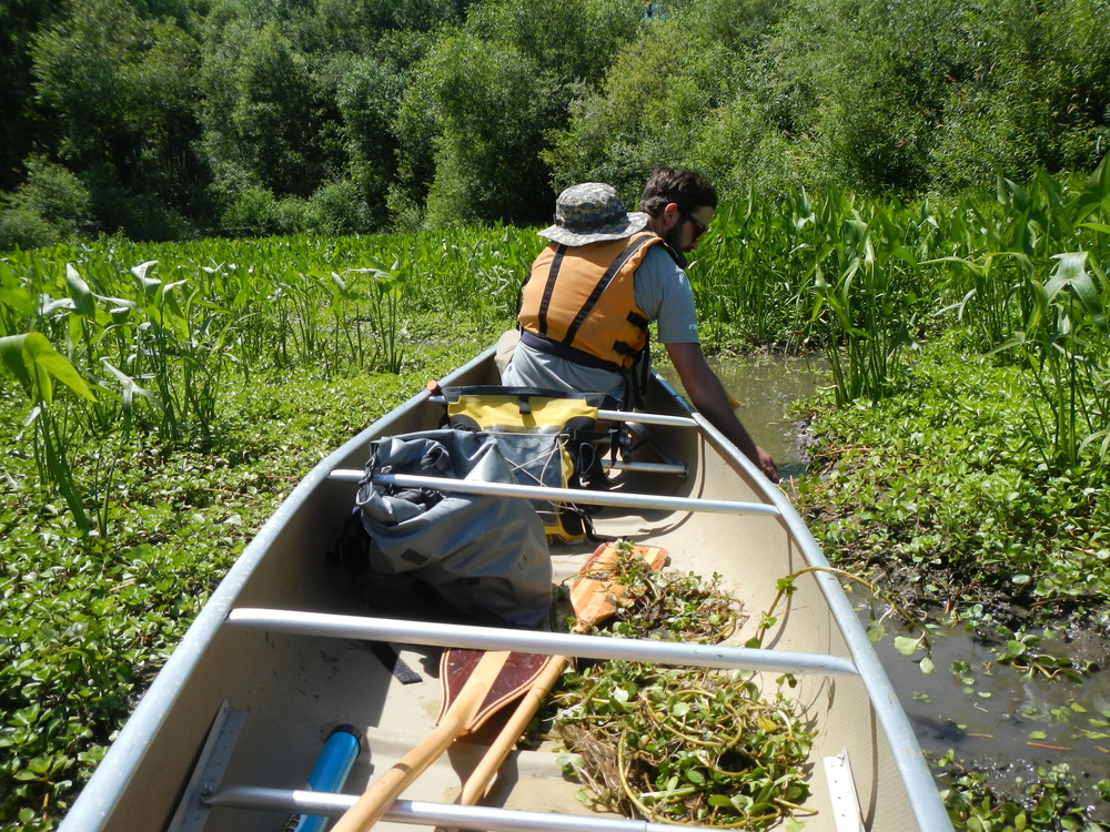
HeronPark’s reclamation plan will go well beyond the reclamation requirements in the 2023 permit between Department of State Lands (DSL) and Ross Island Sand & Gravel Co. The plan will include:
- completing the work required in the 2023 DSL permit,
- designing and building a protective cap over the PHSS sediments,
- demolishing and removing old sand and gravel equipment from Hardtack
Island, - removing the industrial debris on Hardtack Island,
- mitigating the harmful algae blooms,
- restoring the land to create a natural setting for a nature park,
- providing a strong financial assurance plan to make sure all the work gets
done and is maintained for the long term. - HeronPark’s acquisition will include Ross Island (except for the 50 acres owned by the City of Portland), Ross Island lagoon, Hardtack Island and East Island.
Q: Will the reclamation of Ross Island include sediments/soils from sites other than the Portland Harbor Superfund Site?
Yes. Implementation of the reclamation plan and construction of the cap will require clean “Class A” fill. This will likely come from navigational dredging in the Willamette and/or Columbia Rivers. Sediment/fill from other environmental restoration projects may be considered for placement under the cap in accordance with the fill quality requirements that will be established in the new Department of State Lands permit.
Q: When will HeronPark close on its acquisition of Ross Island and become its owner, and who is responsible for Ross Island until then?
HeronPark anticipates closing on its acquisition of Ross Island in the 2027-2028 timeframe in association with the Department of State Lands permit process. Until then, the R.B. Pamplin Corporation remains the owner of Ross Island and remains responsible for it.
Q: How will the reclamation be funded and how will it impact taxpayers?
The reclamation of Ross Island will be self-funded by user fees paid by the responsible parties for the Portland Harbor Superfund Site. No taxpayer funds will be required. Furthermore, the reclamation of Ross Island will save taxpayers money because the State of Oregon, the City of Portland and the Port of Portland are potentially responsible parties for the superfund site cleanup. Sending the sediments to Ross Island will be less expensive than alternative sites further away.
Q: How can the community be confident that the completed nature preserve will be transferred to public ownership?
HeronPark is engaging with public agencies about commitments to accept ownership of the completed nature preserve. A formal commitment is anticipated prior to HeronPark submitting its formal permit application to the Department of State Lands (DSL) in 2027-2028, and possibly sooner. The post-closure care trust that will be part of the financial assurance plan in the DSL permit application will provide an endowment that will avoid the future nature preserve becoming a liability and burden on any accepting public agency.
Q: How will the community be involved with the reclamation plan?
HeronPark’s application for a Department of State Lands permit, expected in 2027-2028, will require a fully transparent public comment process. Additionally, HeronPark is engaging with community groups to listen to the community’s priorities for the reclamation and future of Ross Island. Updates will be provided via this website. Feedback from all interested members of the community will help shape the final plan.
Q: Will the tribes be consulted on the reclamation and future of Ross Island?
Yes. HeronPark is reaching out to tribal governments that have ancestral rights related to the Willamette River and/or are interested in the future of Ross Island along with members of the tribal community in the Portland metropolitan area. This consultation process will help guide the plan for reclaiming Ross Island and managing its future.
Q: How will the transportation and placement of Portland Harbor Superfund Site sediments in Ross Island and its reclamation impact air emissions?
Transporting and placing Portland Harbor Superfund Site sediments in Ross Island will reduce air emissions, especially harmful diesel particulate matter (DPM) emissions, by over 99% in comparison to transporting the sediments to alternative sites in Eastern Oregon. This is because: 1) Ross Island is approximately 1/20th of the distance; 2) the sediments will be transported to Ross Island by tugs/barges, which emit less than 1/10th of the emissions of trucks and/or rail transport per ton-mile; and 3) HeronPark intends to utilize tugboats that have special, high efficiency DPM filters, plus electric utility boats.
Q: Will the reclamation of Ross Island consider seismic stability?
The deep pit under the Ross Island lagoon currently has steep underwater slopes -- as much as 20%. HeronPark’s reclamation plan will make these slopes much gentler and more stable, even when a major earthquake happens. Additionally, the financial assurance plan will provide adequate funding to repair the cap if it is ever damaged by an earthquake.
Q. Is groundwater migration of contaminants a risk to the underlying aquifer or the Willamette River?
Groundwater migration will be a topic addressed in HeronPark's formal permit application to the Oregon Department of State Lands and Department of Environmental Quality in the 2027-2028 timeframe. This topic will be informed by a prior site investigation of the lagoon which found that groundwater at Ross Island generally moves upward toward the lagoon. This means contaminants are not expected to move downward into the underlying groundwater layers beneath the site. In other words, the lagoon is the water body that groundwater naturally discharges to, not the underlying aquifer. The report also concluded that this groundwater pathway up into the lagoon does not create an unacceptable risk based on the investigation results. This conclusion was supported by a flux chamber seepage study, which used chambers placed on the lagoon bottom to measure groundwater movement, and by groundwater level measurements during tidal monitoring, which showed that groundwater was moving upward toward the lagoon. These findings indicate that the deeper aquifer beneath the site is not expected to receive contaminants from the impacted sediments. Another key consideration is that the Portland Harbor Superfund Site sediments that would qualify for acceptance would contain relatively non-mobile contaminants that tend to adhere to the fine grained sediments (see the FAQ about the definition of non-hazardous).
The cap of clean sediments that will be constructed over the sediments from the Portland Harbor Superfund Site will be engineered to prevent contaminants from migrating upward into the Ross Island lagoon.
Q: How will HeronPark’s reclamation plan address the harmful algae blooms?
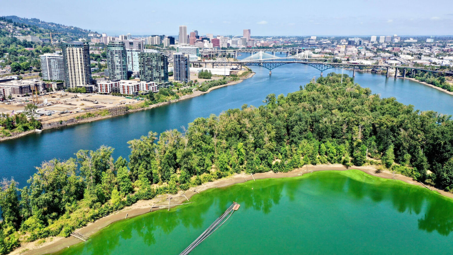
Solving the harmful algae bloom (HAB) problem at Ross Island lagoon will be a top priority for the reclamation plan and for the future nature park. HAB mitigation will happen in three phases:
a. Before placing PHSS sediments:
- HeronPark will evaluate different solutions for controlling algae blooms, including methods studied by Oregon State University and new approaches developed by Tetra Tech.
- The current property owner will also use a turbidity curtain across the lagoon’s opening to Holgate Slough to help contain algae
b. During placement of PHSS sediments:
- Based on what is learned in the first phase, HeronPark will use the most effective algae control methods while placing sediments. During this time (between July 1 and October 31), HeronPark will deploy a dual system of turbidity curtains to avoid cloudy water and algae from escaping the lagoon.
c. After reclamation and during long term park operation:
- The long-term plan for controlling algae will use the best strategies identified in the first two phases, ensuring the lagoon remains healthy as a nature park.
Q: Will people be able to visit Ross Island prior to completion of the reclamation and nature preserve?
HeronPark envisions limited docent-led public visits to Ross Island when it is safe and when operations allow. The reclamation will coincide with the placement of sediments in the Ross Island lagoon during the dredging window for the Portland Harbor cleanup, which is primarily between July 1st and October 31st of each year to comply with state-required in-water work windows. This limited dredging window avoids impacting migratory fish. During the placement of sediments, it will be unsafe for the public to visit. Outside the dredging window, HeronPark plans to conduct other reclamation activities, such as removal of the former sand and gravel equipment and debris, removal of invasive species and planting of native plants. HeronPark anticipates that there will be intervals during winter/spring when it will be safe for docent-led groups to visit the island and observe the wildlife, habitat and reclamation progress.
Q: How will public access be managed after completion of the nature preserve?
Public access to the completed nature preserve will be managed by the public agency that becomes the owner of the preserve.
Q: Will the reclamation of Ross Island provide job opportunities for local community members?
Yes. HeronPark anticipates a year-round staff. During the July to October dredging window, the staff will be primarily engaged with managing the secure placement of sediments in the Ross Island lagoon. In other months, the staff will focus on removing the old sand and gravel mining and processing infrastructure and the industrial debris on Hardtack Island. The staff will also be involved in managing and implementing habitat restoration activities. HeronPark will seek to hire locally, provide training, and engage with local community colleges and universities to facilitate internship and degree programs that lead to careers in environmental restoration and environmental engineering.
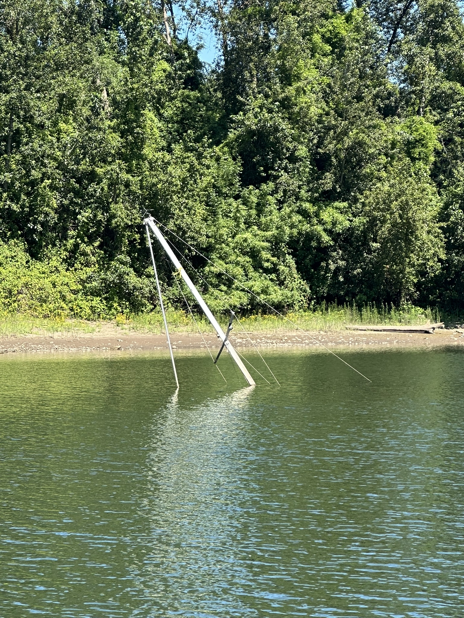
Q: Will the abandoned boats around Ross Island be removed?
Q: How will the reclamation plan deal with climate change and future flooding?
The reclamation plan will be designed to handle bigger floods and hotter summers that may come with climate change.
The cap of clean material that will be constructed over the Portland Harbor Superfund Site sediments will be designed to protect it and the underlying sediments from scour during future floods. The resilience of the cap will be aided by the top of the cap being at an elevation below the river bottom. This, and the configuration of the island surrounding the cap, will help protect it from flood scour. Additionally, due to its lower elevation, the cap will gain natural deposits of clean river sediments over time, adding more protection. The cap design and its protection from future floods will be a topic addressed in HeronPark's formal permit application to the Oregon Department of State Lands and Department of Environmental Quality in the 2027-2028 timeframe.
Q: How will the reclamation plan improve habitats for fish and wildlife?
Q: Is it safe to put non-hazardous, but still impacted, sediments from the Portland Harbor Superfund Site into the Ross Island lagoon?
Yes, it is considered safe to place non-hazardous sediments from the Portland Harbor Superfund Site (PHSS) into the Ross Island lagoon. Environmental science and engineering studies support this approach. Similar impacted sediments were previously placed in confined cells in the Ross Island lagoon, and these cells have been monitored and confirmed to perform well for over 20 years without causing harm to people or the environment.
The process would involve placing PHSS sediments in the 120-foot-deep pit that exists under the lagoon and covering them with an engineered cap of clean material. This cap would safely contain the sediments and prevent them from mixing with river water. Because the cap will be located below the river bottom, natural river sediments will gradually settle on top, adding more protection over time. The design of the cap and the configuration of the island will protect the cap from scour during future floods.
Q: How can the community be sure that the reclamation will be completed and the cap will be monitored and maintained?
The reclamation plan will require prior approval from the Oregon Department of State Lands (DSL) as part of the permitting process. The permit application from HeronPark will include a financial assurance plan that will include standard and financially reliable bonds that will assure that the reclamation will be completed and a post-closure trust will be funded. The post-closure trust will provide an endowment that will be sufficient to pay, in perpetuity, for monitoring and maintenance of the cap, continuation of mitigation of harmful algae blooms, and insurance to protect against changes in regulatory requirements, earthquakes and general liability. Additionally, the endowment will provide funding for future operations of the nature preserve. The financial assurance plan will be implemented prior to any placement of PHSS sediments in Ross Island lagoon.
Q: What is the schedule for permitting the reclamation plan, implementing the reclamation and completing the nature preserve?
HeronPark’s reclamation of Ross Island is anticipated to begin in July 2029 and extend to 2040 to 2042. This is based on the schedule for the PHSS, which is determined by the USEPA and the potentially responsible parties (PRPs). Commitments from the PRPs for the volumes of sediments that will be placed in the Ross Island lagoon are expected to occur in late 2026 and 2027. The reclamation plan will be designed to accommodate these volume commitments in 2027. The reclamation design, financial assurance plan and other details about the reclamation will be submitted to the DSL as part of HeronPark’s application in 2027-2028.
The DSL evaluation of the permit application will involve a public comment process. It is anticipated that the DSL permit will be issued, the financial assurance plan will commence, and the site will be prepared in the late 2028 – early 2029 timeframe to receive sediments in July 2029.
The regulatory review and permitting process will include involvement of Oregon Department of Environmental Quality, the Oregon Department of Fish and Wildlife, the Oregon State Marine Board, the City of Portland, the US Environmental Protection Agency (USEPA), the US Army Corps of Engineers, the US Department of Fish & Wildlife and the National Oceanic and Atmospheric Administration.
There is a possibility that the schedule could move faster and the placement of sediments and the reclamation could begin in July 2028, but this would depend on the schedules of the USEPA, the PHSS PRPs and the regulatory and permitting process aligning better than expected.
Q: What will be included in HeronPark’s reclamation plan?
HeronPark’s reclamation plan will go well beyond the reclamation requirements in the 2023 permit between DSL and Ross Island Sand & Gravel Co. The plan will include:
- completing the work required in the 2023 DSL permit,
- designing and building a protective cap over the PHSS sediments,
- demolishing and removing old sand and gravel equipment from Hardtack
Island, - removing the industrial debris on Hardtack Island,
- mitigating the harmful algae blooms,
- restoring the land to create a natural setting for a nature preserve,
- providing a strong financial assurance plan to make sure all the work gets
done and is maintained for the long term. - HeronPark’s acquisition will include Ross Island (except for the 50 acres owned by the City of Portland), Ross Island lagoon, Hardtack Island and East Island.
Q: Will the reclamation of Ross Island include sediments/soils from sites other than the Portland Harbor Superfund Site?
Yes. Implementation of the reclamation plan and construction of the cap will require clean “Class A” fill. This will likely come from navigational dredging in the Willamette and/or Columbia Rivers. Sediment/fill from other environmental restoration projects may be considered for placement under the cap in accordance with the fill quality requirements that will be established in the new DSL permit.
Q: When will HeronPark close on its acquisition of Ross Island and become its owner, and who is responsible for Ross Island until then?
HeronPark anticipates closing on its acquisition of Ross Island in the 2027-2028 timeframe in association with the DSL permit process. Until then, the R.B. Pamplin Corporation remains the owner of Ross Island and remains responsible for it.
Q: How will the reclamation be funded and how will it impact taxpayers?
The reclamation of Ross Island will be self-funded by user fees paid by the responsible parties for the Portland Harbor Superfund Site. No taxpayer funds will be required. Furthermore, the reclamation of Ross Island will save taxpayers money because the State of Oregon, the City of Portland and the Port of Portland are potentially responsible parties for the superfund site cleanup. Sending the sediments to Ross Island will be less expensive than alternative sites further away.
Furthermore, the reclamation of Ross Island will save taxpayers money because the State of Oregon and the City of Portland are PRPs for the superfund site cleanup.
Q: How can the community be confident that the completed nature preserve will be transferred to public ownership?
HeronPark is engaging with public agencies about commitments to accept ownership of the completed nature preserve. A formal commitment is anticipated prior to HeronPark submitting its formal permit application to DSL in 2027-2028, and possibly sooner. The post-closure care trust that will be part of the financial assurance plan in the DSL permit application will provide an endowment that will avoid the future nature preserve becoming a liability and burden on any accepting public agency.
Q: How will the community be involved with the reclamation plan?
HeronPark’s application for a DLS permit, expected in 2027-2028, will require a public comment process. Additionally, HeronPark is engaging with community groups to listen to the community’s priorities for the reclamation and future of Ross Island.
Q: Will the tribes be consulted on the reclamation and future of Ross Island?
Yes. HeronPark is reaching out to the tribes that have ancestral rightsm related to the Willamette River and/or are interested in the future of Ross Island. This consultation process will help guide the plan for reclaiming Ross Island and managing its future.
Q: How will the transportation and placement of Portland Harbor Superfund Site sediments in Ross Island and its reclamation impact air emissions?
Transporting and placing Portland Harbor Superfund Site sediments in Ross Island will reduce air emissions, especially harmful diesel particulate matter (DPM) emissions, by over 99% in comparison to transporting the sediments to alternative sites in Eastern Oregon. This is because: 1) Ross Island is approximately 1/20th of the distance; 2) the sediments will be transported to Ross Island by tugs/barges, which emit less than 1/10th of the emissions of trucks and/or rail transport per ton-mile; and 3) HeronPark intends to utilize tugboats that have special, high efficiency DPM filters, plus electric utility boats.
Q: Will the reclamation of Ross Island consider seismic stability?
The deep pit under the Ross Island lagoon currently has steep underwater slopes -- as much as 20%. HeronPark’s reclamation plan will make these slopes much gentler and more stable, even when a major earthquake happens. Additionally, the financial assurance plan will provide adequate funding to repair the cap if it is ever damaged by an earthquake.
Q: How will HeronPark’s reclamation plan address the harmful algae blooms?
Solving the harmful algae bloom (HAB) problem at Ross Island lagoon will be a top priority for the reclamation plan and for the future nature preserve. HAB mitigation will happen in three phases:
a. Before placing PHSS sediments:
- HeronPark will evaluate different solutions for controlling algae blooms, including methods studied by Oregon State University and new approaches developed by Tetra Tech.
- The current property owner will also use a silt curtain across the lagoon’s opening to Holgate Slough to help contain algae
b. During placement of PHSS sediments:
- Based on what is learned in the first phase, HeronPark will use the most effective algae control methods while placing sediments. During this time (between July 1 and October 31), HeronPark will deploy a dual system of silt curtains to avoid cloudy water and algae from escaping the lagoon.
c. After reclamation and during long term park operation:
- The long-term plan for controlling algae will use the best strategies identified in the first two phases, ensuring the lagoon remains healthy as a nature preserve.
Q: Will people be able to visit Ross Island prior to completion of the reclamation and nature preserve?
HeronPark envisions limited docent-led public visits to Ross Island when it is safe and when operations allow. The reclamation will coincide with the placement of sediments in the Ross Island lagoon during the dredging window for the Portland Harbor cleanup, which is primarily between July 1 and October 31 each year. This limited dredging window avoids impacting migratory fish. During the placement of sediments, it will be unsafe for the public to visit. Outside the dredging window, HeronPark plans to conduct other reclamation activities, such as removal of the former sand and gravel equipment and debris, removal of invasive species and planting of native plants. HeronPark anticipates that there will be intervals during winter/spring when it will be safe for docent-led groups to visit the island and observe the wildlife, habitat and reclamation progress.
Q: How will public access be managed after completion of the nature preserve?
Public access to the completed nature preserve will be managed by the public agency that becomes the owner of the preserve.
Q: Will the reclamation of Ross Island provide job opportunities for local community members?
Yes. HeronPark anticipates a year-round staff. During the July to October dredging window, the staff will be primarily engaged with managing the secure placement of sediments in the Ross Island lagoon. In other months, the staff will focus on removing the old sand and gravel mining and processing infrastructure and the industrial debris on Hardtack Island. The staff will also be involved in managing and implementing habitat restoration activities. HeronPark will seek to hire locally and to engage with local universities to create internship programs that lead to careers in environmental restoration and environmental engineering.
Q: Will the abandoned boats around Ross Island be removed?
The abandoned boats around Ross Island are a big concern of HeronPark, and HeronPark as a future landowner will cooperate with and encourage the government agencies that have jurisdiction over abandoned boats around Ross Island and elsewhere in the State of Oregon. Since 2023 the DSL has administered the Abandoned and Derelict Vessel (ADV) Program and has been appropriated over $18 million to implement it.
Q: How will the reclamation plan deal with climate change and future flooding?
The reclamation plan will be designed to handle bigger floods and hotter summers that may come with climate change.
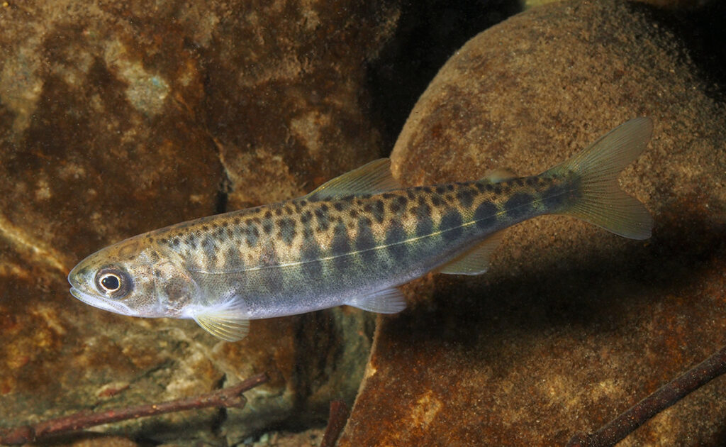
Q: How will the reclamation plan improve habitats for fish and wildlife?
The reclamation plan will improve the habitat quality by removing invasive plants and planting native plants and improving wetlands. It will also increase the amount of habitat by reclaiming the former sand and gravel processing area on Hardtack Island into excellent habitat. The reclamation plan will also foster improved habitat management by integrating management of the Ross Island habitat with that of the nearby Oaks Bottom Wildlife Refuge.